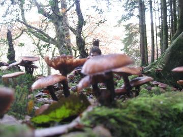
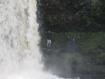
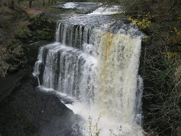
The first in a series of posts on the beautiful Brecon Beacons, here’s Countryfile’s fantastic guide to the stunning waterfalls at Ystradfellte. My friends and I walked them all last month – a perfect Sunday trek through mossy woods and past indifferent sheep. We only saw four or five other walkers during the day. Take waterproofs if you want to walk directly under the falls (an amazing experience!).
START Park at the lay-by near to Clyn Gwyn Bunkhouse and walk down a bridleway. Turn right (signed waterfall walk) and follow a wide path. After 500m turn right to a viewing platform over the impressive Sgwd Isaf Clun Gwyn. Retrace your steps then turn right and walk through woodlands until you see the Sywd Clun Gwyn. Continue on the high path then turn right to the falls. If the water level is low you can explore the moss-covered rocks and even clamber down to the shelf to watch the water cascade into the valley.
Back on the path, take the peaceful route alongside the river. Cross a wooden bridge by a pebbled bank and turn right onto a rocky path. Keep right and walk along the ancient riverbed, evidence of the river’s course before it cut further into the limestone. Follow the path right to a viewpoint overlooking Sgwd Clun Gwyn.

1 MILE Walk left on a narrow path that weaves over tree roots. Be careful of your step and keep an eye on children near the edge. Descend with the path down to the river, bearing right to look at Sgwd Isaf Clun Gwyn, a long curved waterfall dripping with mosses.
Pick your way carefully downstream to a deep pool and a peaceful spot beneath a three-tiered fall that makes for a beautifully composed photo. Amble further downstream to Sgwd y Pannwr as the river turns sharply and tumbles into a deep pool surrounded by overhanging trees.

1.5 MILES Turn back on yourself and take the path right, then turn off immediately right to follow an unclear rocky path. Take a left steeply uphill and climb out of the valley, then follow the path right. Bear left through lush woodland and dappled sunlight. Turn right and head steeply downhill to a grassy bank, then turn left and follow the river to a two-tiered waterfall in a delightfully peaceful spot.
Head back the way you came and rejoin the path, turning right. When the path drops down to the riverside you can walk alongside the river to Wales’ best-known waterfall, Sgwd yr Eira. Until recently you could walk behind the falls but the path is now closed due to unstable rocks.

2 MILES Turn back and walk up steps. Turn left then take the top route and continue above the tree line. Carry straight on at a junction, then stick to the upper path, bearing right, and turn right to return to the viewing platform at Sgwd Clun Gwyn. Walk uphill, turn left at the top and follow the path back to the bridge.
Carry straight on alongside the river bank until you reach Cwm Porth, an eco-friendly information centre, with picnic and toilet facilities. Walk down from the car park to explore Porth Yr Ogof, one of the largest cave entrances in Wales. At 20m wide and 3m high you can safely explore the opening of the cave (don’t forget your torch). Look out for calcite streaks on the back wall that resemble a white horse, giving the cave its name.
4 MILES Walk back to Cwm Porth, cross the road and retrace your steps. For an interesting detour, turn right through a gate, signed Access for Cavers, and walk over the ancient water-worn riverbed to the resurgence pool where the River Mellte gushes out from its underwater course.
Back on the path, turn right then left to rejoin the main path. Cross the bridge and follow the path back to the bunkhouse car park.

INFO
Terrain: Steep and rocky paths, challenging in places with some scrambles, steps or tree routes to negotiate. Extreme care should be taken when exploring the opening of Porth yr Ogof. Many people have drowned in these caves and further exploration should only be attempted by well-equipped experienced cavers or under the close supervision of a qualified instructor with excellent local knowledge.
Car: Leave the M4 at J32 and take the A470 for 14 miles towards Merthyr Tydfil, then the A465 towards Neath and take the exit for A4109 (signed for caves) to Pontneddfechan. Head north on the B4242 to Ystradfellte and the bunkhouse and car park is on this road.
Public Transport: Aberdare is served by direct trains from Cardiff.

This looks beautiful, may have to take a visit here.